By Carsten Brinkschulte, CEO and Co-Founder, Dryad Networks
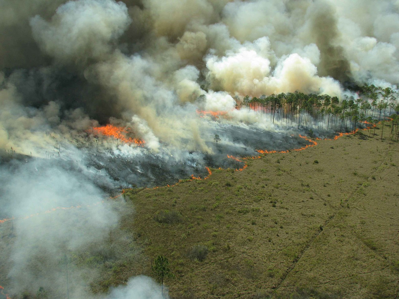
Periods of hot, dry weather can turn a forest’s undergrowth into perfect kindling. Any hot spark can set dry undergrowth aflame. Wildfires are a huge and growing problem. They cause around 20% of global CO2 emissions, almost the same as all traffic worldwide. Burning forests not only decimate the world’s largest carbon capture and storage system but also eliminate the habitat for two thirds of all biodiversity on earth.
In addition to their environmental impact, wildfires also cause huge economic damage. As recently reported to the United States Congress, climate change-fuelled wildfires are costing the US economy between $394 billion to $893 billion annually.
By detecting wildfires while they are still small, we stand a much better chance of stopping them before they cause too much damage, saving money, the environment and, ultimately, lives.
Classic wildfire detection: watchtowers
If you haven’t seen a watchtower in and around a forest, you will likely have watched a movie or TV show where one has been featured. As a way to spot fires, watchtowers have been important for some time. Recently, Artificial Intelligence (AI) enhanced cameras have been mounted on watchtowers adding a sci-fi spin to this classic fire detection method.
Multiple watchtowers make it possible to triangulate and send firefighters to the exact location of a fire. Fire watchers can then use the towers to keep track of the size and location of the fire as it progresses.
Watchtowers—manned by humans, cameras or AI—have the advantage of being able to overlook a large area, with a single watchtower having an observable radius of up to 18km.
However, watchtowers have limitations. Smoke has to rise above the tree canopy to become visible from a watchtower, and tree canopies hold down smoke. It is pretty much impossible to detect a small fire underneath a tree canopy, which is where the vast majority of wildfires start. By the time they are large enough to be seen, they will have been burning for hours and may be too large to extinguish by the time the firefighters arrive at the scene.
The other main issue with watchtowers is visibility. Haze, fog or dust from crop harvesting can obscure visibility or cause false-positives, and of course there are often obstacles such as hills which can block the view.
Space-age wildfire detection: satellites
Satellites offer a different view of potential trouble spots. Satellites can have geostationary orbits (a fixed location relative to Earth) or Low Earth Orbits (LEO), where satellites move relative to the Earth. Both employ camera technology but they are used differently: Geostationary satellites keep watch over one area of forest; LEO satellites work as part of a network to provide global coverage.
With their wide field of view, satellites are excellent at tracking wildfire, but distance is an issue.
Geostationary satellites orbit the Earth at distances around 36,000km. This far from the ground, a single pixel is the equivalent of 500x500m. Fires need to be pretty substantial before geostationary satellites can detect them.
While LEO satellites are closer to the surface (about 600km above us) and are able to provide better resolution, because they are constantly on the move relative to the Earth’s surface, they only pass each area once every six hours or so. In six hours a fire could have shifted from smouldering to unstoppable. Hundreds of LEO satellites can reduce the revisit time to less than 30 minutes, but even then the resolution on offer is around 100x100m – roughly the size of two football pitches.
Sadly, when it comes to early detection of wildfires, satellites are not ideal. They are superb tools for monitoring wildfires, and the can help predict where and how fires will develop.
New technology: gas sensors
Gas sensors are positioned in forests below the tree canopy and use AI to accurately detect smoke from fires – they can tell this from things such as fumes from vehicles. As gas sensors are typically solar-powered, they can be positioned anywhere and run for more than 10 years without the need for an external power supply or battery swap.
A huge advantage offered by gas sensors is their ability to detect wildfires as early as the smouldering stage where they can be extinguished much more easily and effectively before they spread and become extremely dangerous.
Gas sensors are, therefore, best suited to cover high-risk, high-value areas in the wildland-urban interface (WUI) – places where people hike, camp or drive, power lines and railroad tracks, as well as anywhere else where fires have proven more common.
However, gas sensors have a limited range; one sensor is needed for each five hectares of woodland (more in high-risk areas). A lot less than a satellite. But they also cost much less than a satellite – less than $100 per sensor, so the overall protection cost is still very competitive when compared to other approaches.
Combining detection methods
There are advantages but also limitations to every wildfire detection approach. There is no silver bullet that will solve the growing wildfire crisis on its own. Watchtowers, cameras and satellites often require the fire to have reached a certain size and intensity before it can be detected while sensor-based approaches are effective in the WUI but impractical to cover the entire forest.
However, by combining multiple solutions, it is possible to create an optimal system. The advantages of one approach can be used to cancel out the disadvantages of another.
Since most wildfires are caused by human activity, it makes sense to focus gas sensors on WUI areas ─ the areas of forest that come into most contact with people ─ which are the highest risk. Since these areas are relatively small, they can be effectively covered by gas sensors for ultra-early detection at a low cost. Despite currently being relatively small in area, they are increasing by around two million acres a year, and they are the very area where wildfires can wreak the most damage, owing to their proximity to humans and human infrastructure. This makes ultra-early detection especially important in an area where sensor-based approaches are far superior.
If a wildfire does develop outside of the high-risk areas or out of view of the cameras, it can then be detected and tracked using satellites, helping to reduce the damage and loss of life.
By combining all three approaches, we could effectively manage the majority of wildfires before they become too large and unmanageable. Not only would this save forests but it would also save homes, livelihoods and lives, both of the public and of firefighters tackling the blaze.
In the future, we may even be able to combine these detection methods with automated extinguishing machines – drones carrying small payloads of water or other extinguishing methods to the location of a small fire. These drones won’t be able to tackle large fires, so early detection is crucial for their efficacy. Yet, with a fleet of automated drones directed by accurate ultra-early detection systems, we could all but eliminate destructive wildfires for good.
ABOUT THE AUTHOR
Carsten Brinkschulte is CEO and co-founder of Dryad Networks. Dryad provides ultra-early detection of wildfires as well as health and growth-monitoring of forests using solar-powered gas sensors in a large-scale IoT sensor network. Dryad aims to reduce unwanted wildfires, which cause up to 20% of global CO2 emissions and have a devastating impact on biodiversity. By 2030, Dryad aims to prevent 3.9m hectares of forest from burning, preventing 1.7bn tonnes of CO2 emissions.
Website: https://www.dryad.net/
Social:
https://www.facebook.com/dryadnetworks/
https://twitter.com/DryadNetworks
https://www.linkedin.com/company/dryadnetworks/
Sources:
https://wfca.com/articles/how-fast-do-wildfires-spread
https://www.iii.org/fact-statistic/facts-statistics-wildfires
https://hrcak.srce.hr/file/353960
https://www.dryad.net/wildfiresensor
https://svs.gsfc.nasa.gov/11107
https://www.fao.org/documents/card/en/c/ca8985en